Tag: Mars Express

  • Scientists Record Most Intense Solar Superstorm on Mars

    Scientists Record Most Intense Solar Superstorm on Mars

    Key Takeaways

    1. A solar storm occurs when the Sun releases a large amount of energy and particles into space, including solar flares and coronal mass ejections (CMEs).
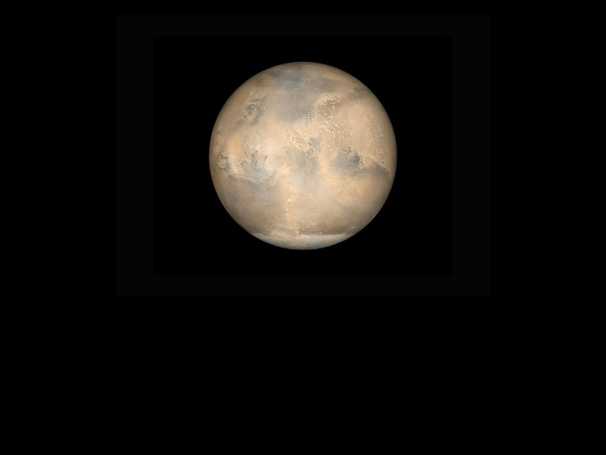
    2. In May 2024, the largest solar storm in over 20 years caused stunning auroras on Earth and directly heated the Martian atmosphere due to Mars’ weak magnetic field.
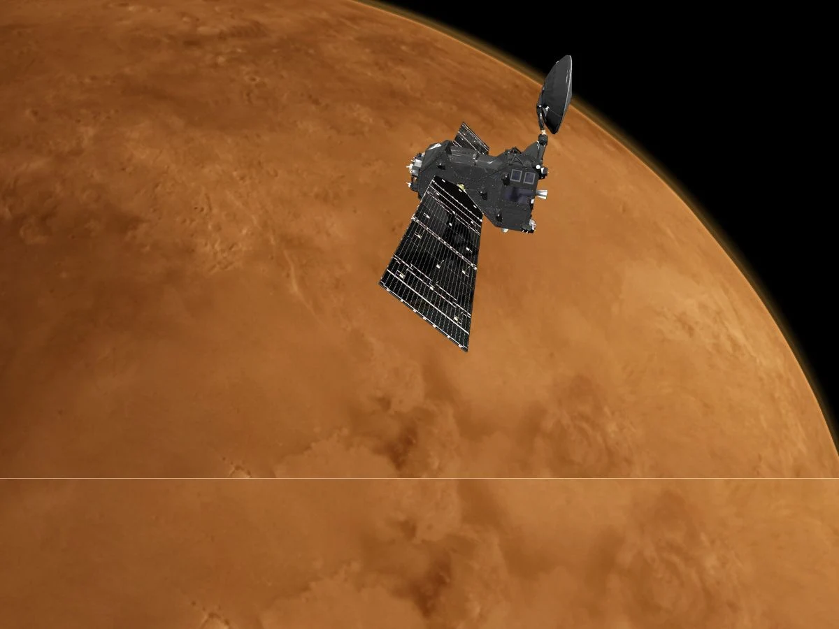
    3. The Mars Express and ExoMars Trace Gas Orbiter were active during the storm, providing valuable data on the interaction between solar particles and Mars’ atmosphere.
    4. The ionization process on Mars involved solar particles colliding with atmospheric atoms, which is crucial for understanding solar activity’s effects on Mars.
    5. The “radio occultation” technique was used to gather data shortly after the solar flare, with support from NASA’s MAVEN mission, aiding future Mars missions and space weather predictions.


    A solar storm happens when the Sun unexpectedly releases a lot of energy and particles into space. These powerful eruptions can consist of solar flares, coronal mass ejections (CMEs), and energetic charged particles. In May 2024, the Sun unleashed the largest solar storm in more than 20 years. On Earth, this created amazing auroras. On Mars, however, the situation was different. The absence of a strong magnetic field like Earth’s allowed solar particles to directly heat the Martian atmosphere.

    Spacecraft In Action

    During the storm, two spacecraft were in orbit around Mars: the Mars Express and the ExoMars Trace Gas Orbiter. The solar storm introduced particles that collided with atmospheric atoms, removing electrons from them and generating ions through a process known as ionization in Mars’ ionosphere. This interaction was significant in understanding the effects of solar activity on the Martian environment.

    Innovative Techniques

    A technique referred to as “radio occultation” was employed, where radio signals were transmitted from the Mars Express and captured by the ExoMars Trace Gas Orbiter. This method was utilized just ten minutes after the solar flare impacted Mars. Data from NASA’s MAVEN mission helped confirm the findings. Grasping these phenomena is crucial for upcoming Mars missions and predicting space weather effectively.

    Source:
    Link


  • Ancient Arabia Terra: Cratered History of Mars Uncovered

    Ancient Arabia Terra: Cratered History of Mars Uncovered

    Key Takeaways

    1. Arabia Terra is one of the oldest regions on Mars, dating back 3.7 to 4.1 billion years from the Noachian period.
    2. Trouvelot Crater, a significant feature in Arabia Terra, is about 130 km wide and shows signs of erosion and age.
    3. The floors of some craters contain dark materials, possibly indicating the presence of mafic minerals from volcanic rocks.
    4. Barchan dunes within Trouvelot Crater suggest a consistent wind direction on Mars.
    5. Light-colored mounds in the area contain minerals that may indicate past water activity, enhancing our understanding of Mars’ geological history.


    Arabia Terra is a region found in the northern part of Mars’ southern highlands. It is one of the oldest areas on the planet, with its surface dating back between 3.7 and 4.1 billion years, originating from the Noachian period. During this time, the planets faced heavy bombardment from asteroids and comets, leaving behind impact scars that are still visible on Mars today.

    Trouvelot Crater

    One of the significant features in the area is the Trouvelot Crater, which spans about 130 km in width and is very ancient. Signs of its age can be seen in the eroded rim of the crater, the terraced walls, and the craters that overlap it. Nearby, another crater has been identified that is even older, with its rim nearly fully eroded.

    Geological Features

    Some floors of the craters appeared to be dark, which scientists think might be due to the presence of mafic minerals that are typically found in volcanic rocks. Within the Trouvelot Crater, curved formations known as barchan dunes indicate that there is a consistent wind direction on Mars. Additionally, light-colored mounds were noted containing minerals that form when in contact with water, hinting at possible past water activity.

    The image was taken by a high-resolution stereo camera aboard the Mars Express, an orbiter launched by the European Space Agency in 2003, aimed to observe Mars’ atmosphere and surface. This research provides insights into potential past water activity and enhances our understanding of the geological history of Mars.

    Source:
    Link


  • Mars Express Reveals Intense Sandblasting on the Red Planet

    Mars Express Reveals Intense Sandblasting on the Red Planet

    Key Takeaways

    1. Mars Express has been studying the Martian terrain since 2003, revealing unique geological features.
    2. Powerful Martian winds have shaped ridges, creating yardangs through the erosion of softer sedimentary rock.
    3. The uniform direction of the yardangs indicates the prevailing wind patterns on Mars.
    4. The image also shows platy flow, which is formed by cooled lava, suggesting complex geological processes.
    5. The relationship between yardangs and platy flow indicates that yardangs are a more recent geological feature on Mars.


    Mars Express has been surveying the Martian terrain since the year 2003, uncovering many striking features. A recent image reveals the intense sandblasting occurring on the Red Planet, taken by the High Resolution Stereo Camera (HRSC) that is part of the orbiter.

    Distinctive Features of the Martian Surface

    The image showcases ridges located on the left side of a relatively new impact crater. These ridges were shaped by powerful Martian winds. The strong gusts lifted sand particles and propelled them against the sedimentary rock, eroding the softer layers while leaving the tougher ones intact. This process led to the creation of the unique sculptures visible in the picture, known as yardangs.

    Direction of the Winds

    All of the yardangs are angled in the same direction, allowing scientists to infer the direction of the prevailing winds. However, the value of this observation extends beyond just wind direction, providing additional intriguing insights for researchers.

    The image displays three distinct formations: the yardangs, an impact crater, and a phenomenon referred to as “platy flow.” The platy flow is less prominent but formed when lava cooled on the surface while still flowing underneath. This persistent flow fractured the surface into rigid plates that shifted similarly to ice floes found on Earth.

    Recent Geological Activity

    Interestingly, the platy flow is situated both beside and beneath the yardangs, leading scientists to believe that the yardangs were formed atop the platy flow. This indicates that the yardangs are likely a more recent geological development.

    Images like this are aiding scientists in gaining a deeper insight into Mars. The information gathered could be vital for upcoming missions that aim to send humans to the Red Planet.

    Source:
    Link


  • NASA Explores Theory of Underground Lakes on Mars

    NASA Explores Theory of Underground Lakes on Mars

    Key Takeaways

    1. In 2015, ESA’s Mars Express Orbiter captured an image of the ice cap at Mars’ south pole, leading to further investigation of potential liquid water beneath it.
    2. NASA’s Mars Reconnaissance Orbiter used a special technique called the very large roll technique to study the area in depth.
    3. The Shallow Radar (SHARAD) detected a weak signal, suggesting that liquid water may not be present under the ice cap.
    4. Researchers now believe that the bright signal from 2018 may have originated from a smooth rock layer, not an underground lake.
    5. Future exploration using the very large roll technique will focus on other regions of Mars to locate accessible water for potential astronaut missions.


    In 2015, ESA’s Mars Express Orbiter took a photograph of the ice cap located at Mars’ south pole. Three years afterwards, the Mars Advanced Radar for Subsurface and Ionospheric Sounding (MARSIS) instrument aboard the spacecraft caught a bright signal emanating from that region. This signal led scientists to think there might be a lake lying underneath the ice.

    NASA’s Investigation

    NASA’s Mars Reconnaissance Orbiter (MRO) returned to the site. After a lengthy period of attempting to investigate the depths, researchers finally managed to figure it out using a method known as the very large roll technique. This approach involves rolling the spacecraft by 120 degrees, allowing the Shallow Radar (SHARAD) instrument on MRO to gather signals from beneath the icy surface.

    New Findings

    Curiously, SHARAD detected a weak signal. The weakness of this signal suggests that liquid water is probably not lurking under the ice cap. The researchers involved in this study proposed that the underground lake previously thought to exist might actually just be a layer of dust and rock. They theorized that the bright signal noted by MARSIS in 2018 could have originated from a particularly smooth rock beneath the ice.

    The plan for the scientists is to apply the very large roll technique to explore other regions beneath Mars’ surface, such as the Medusae Fossae. These explorations could be vital in identifying locations with accessible water, which would be perfect for future astronaut missions. This research was detailed in a paper published on November 17 in the journal Geophysical Research Letters.


    Source:
    Link