
Key Takeaways
1. Significant ice retreat observed in Antarctica, with grounding lines receding up to 42 kilometers since the 1990s.
2. Approximately 12,800 square kilometers of grounded ice lost between 1996 and 2025, nearly half the size of Belgium.
3. Warmer ocean waters, particularly the Circumpolar Deep Water current, are contributing to the melting of ice shelves from beneath.
4. Over 77% of Antarctica’s coastline remains unchanged, but continued grounding line retreat may accelerate ice loss and raise global sea levels.
5. Satellite data from the Copernicus Sentinel-1 mission is crucial for monitoring changes in polar regions year-round.
For more than three decades, satellites have been discreetly observing Antarctica. A group of researchers, mostly from the University of California, used the data gathered over these years to carry out a study, the results of which were shared in the Proceedings of the National Academy of Sciences (PNAS).
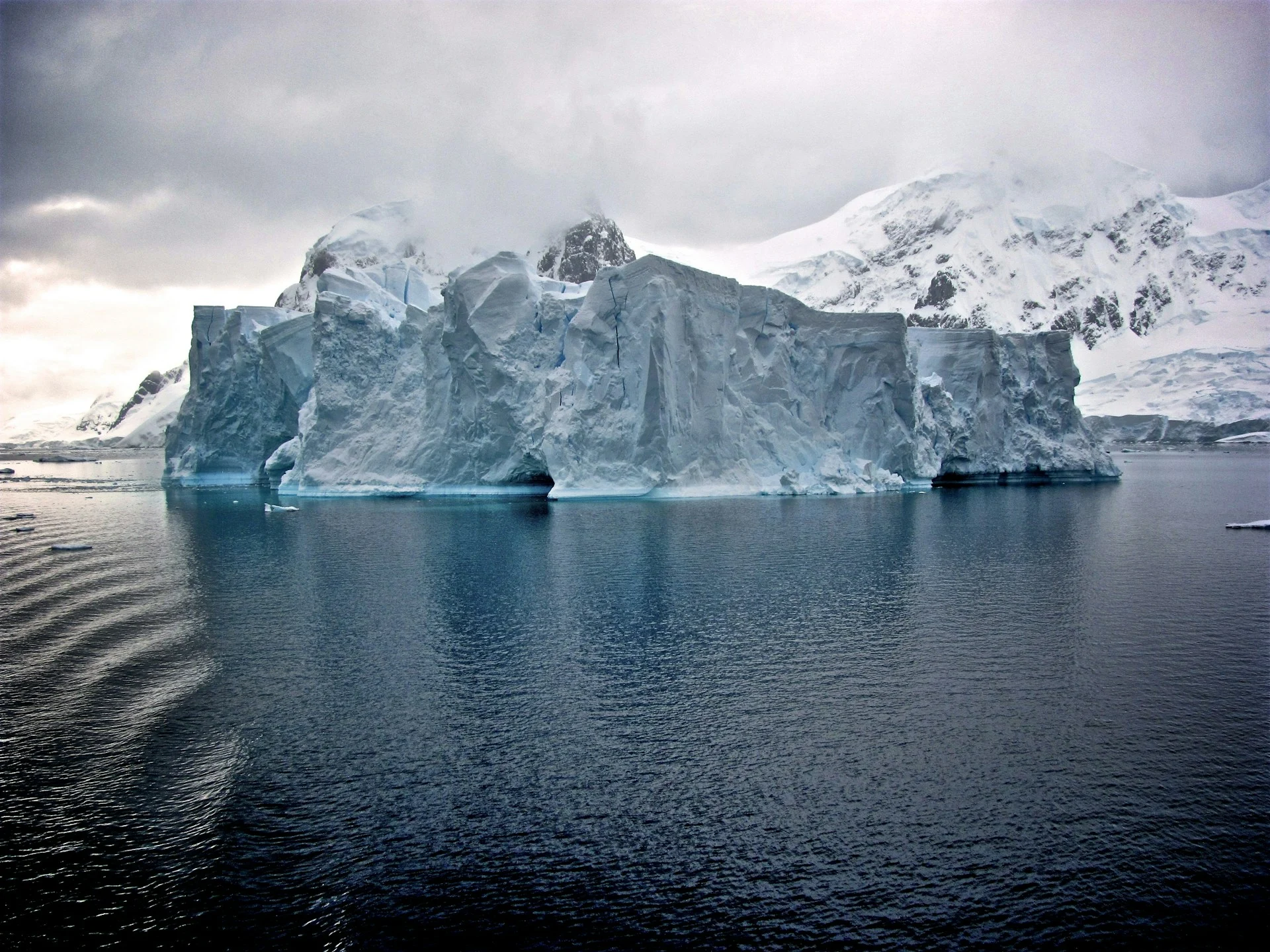
Significant Ice Retreat
The research indicates that certain areas of Antarctica’s grounding lines have receded significantly. Grounding lines are where ice transitions from resting on the land to floating on the ocean. Along the Amundsen Sea in West Antarctica, the ice has pulled back by as much as 42 kilometers since the 1990s. In total, the continent has experienced a loss of approximately 12,800 square kilometers of grounded ice between 1996 and 2025, which is nearly half the size of Belgium.
Role of Warm Ocean Water
Researchers indicate that warmer ocean waters are a key factor in this situation. A current referred to as Circumpolar Deep Water flows beneath the ice shelves, causing them to melt from underneath. As the ice becomes thinner, it becomes less anchored to the bedrock, and when this occurs, the grounding line moves inland — signaling a decrease in the stability of the ice sheet.
The study also highlights that more than 77% of Antarctica’s coastline has remained unchanged. Nonetheless, if the retreating grounding lines continue, this could speed up ice loss and lead to higher global sea levels.
Importance of Satellite Data
To observe the changes noted in this research, scientists heavily depended on information from the Copernicus Sentinel-1 mission, run by the ESA. These satellites utilize radar capable of seeing through clouds and darkness, making them perfect for year-round monitoring of polar areas.
Source:
Link
Leave a Reply