Key Takeaways
1. Wildfires eliminate plant life, leading to increased runoff of ash and debris into water bodies.
2. HydroFlame uses satellite data to assess the impact of wildfires on water flow and quality.
3. The tool forecasts areas at risk for flash floods and water contamination using hydrologic models and machine learning.
4. HydroFlame features a historical viewer, a “what-if” scenario creator, and a predictive tool for weekly forecasts.
5. Currently covering the Clark Fork Basin, HydroFlame plans to expand its services to California and Utah.
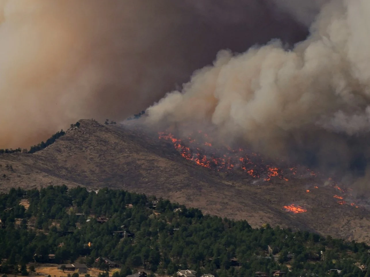
When wildfires strike a community, the natural shield provided by plants is lost. This absence means there are no plants to soak up rainwater. Consequently, ash and debris from burned hillsides flow into nearby water bodies.
Contamination Risks
Such runoff poses a threat to the local water supply. It can also trigger flash floods. These are some of the disasters that HydroFlame aims to avert. This innovative tool utilizes satellite information to create an overview of the conditions on burned landscapes and adjacent watersheds.
Using this data along with records from monitored rivers, hydrologic models are developed. These models illustrate the potential impacts of the fire on both water flow and quality. In regions without gauges, machine learning techniques are employed to supplement the missing data.
Forecasting the Future
Ultimately, all this information leads to a forecast that highlights areas vulnerable to flash floods and water contamination. HydroFlame comes with three main features: a historical viewer, a “what-if” scenario creator, and a predictive tool that produces weekly forecasts. The “what-if” scenario creator and the predictive tool are still under development.
Recently, HydroFlame completed a successful test. It accurately forecasted mudflow events that occurred after the January 2025 wildfires in Los Angeles. However, at that time, the team had not deployed on-ground sensors. This means the results of the test were not verified with data. Still, the trial acts as a practical validation for the effectiveness of HydroFlame.
Expansion Plans
At present, the tool only covers data for the Clark Fork Basin in Montana. However, there are plans to extend its reach to California and Utah in the future.
Source:
Link
Leave a Reply