Key Takeaways
1. DJI’s new Zenmuse L3 sensor module enhances geodata collection for professional and commercial use.
2. The Zenmuse L3 features advanced LiDAR technology, achieving accuracy of ±10 mm over distances of 120 to 300 meters.
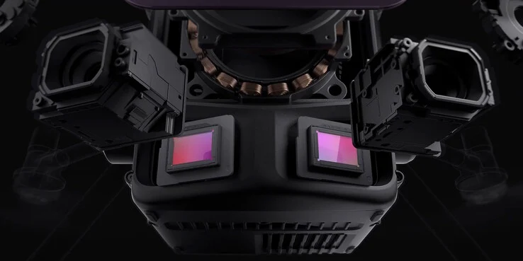
3. It includes two RGB cameras with a 100MP resolution for detailed optical modeling of environments.
4. The system can map an area of 10 km² in a single flight and up to 100 km² in one day.
5. The Zenmuse L3 is priced at approximately €8,000, excluding VAT.
Most people who love technology are probably familiar with DJI’s consumer drones. These devices let you record thrilling videos of yourself or well-known sites from unique perspectives. Yet, drones also serve important roles in professional and commercial settings, often proving to be a more affordable option than using a helicopter.
New Sensor Module Introduction
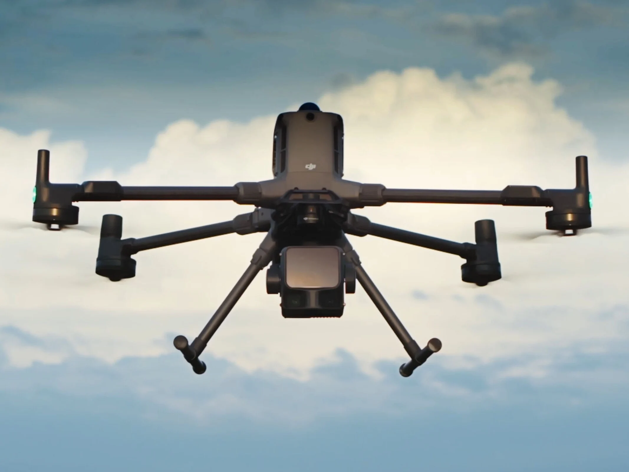
DJI has recently launched the Zenmuse L3, which is another sensor module aimed at this specific market. The company claims that this module can accurately gather geodata, which is useful for tasks like planning the precise path of new roads in less populated areas.
Advanced Technology Features
The Zenmuse L3 features a LiDAR system that sends out electromagnetic waves with a wavelength of 1,535 nm. By measuring the time it takes for the waves to return, the system can calculate how far away the ground or even trees are. Within a distance of 120 to 300 meters, under standard conditions of 25°C and reflective surfaces, DJI guarantees an accuracy of ±10 mm and a repeat accuracy of under 5 mm. This technology generates a point cloud that can be used to build a terrain model.
Impressive Camera Capabilities
In addition to the LiDAR system, the DJI Zenmuse L3 has two RGB cameras with a 28mm full-frame equivalent focal length and a 4/3-inch CMOS sensor boasting a resolution of 100MP. This setup enables the creation of a detailed optical model of the surrounding area. Also, it’s equipped with a GNSS module. When flying at an elevation of 300 meters, a single flight with the DJI Matrice 400 can map out an area of 10 km², and in a single day, it can cover up to 100 km². For example, the entire 415 km² of Vienna could be surveyed in just under a week. The price tag for this latest DJI innovation is approximately €8,000, not including VAT.
Source:
Link