
Key Takeaways
1. NASA’s MRO (Mars Reconnaissance Orbiter) launched on August 12, 2005, and reached Mars orbit in March 2006.
2. The HiRISE (High Resolution Imaging Science Experiment) device on MRO has captured its 100,000th image as of October 7.
3. The milestone image showcases Syrtis Major, located near Jezero Crater, which is being studied by NASA’s Perseverance rover.
4. The image features geological formations like mesas and sand dunes, common subjects for HiRISE, alongside impact craters and ice deposits.
5. Ongoing research aims to uncover the origin of the windblown sand that formed the dunes, contributing to our understanding of Mars for future missions.
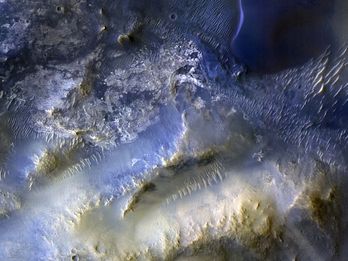
NASA’s MRO lifted off from Earth on August 12, 2005, and entered Mars’ orbit in March 2006. After almost two decades circling the Red Planet, the HiRISE (High Resolution Imaging Science Experiment) device aboard the MRO has taken its 100,000th picture. This milestone image was taken on October 7.
Image Details
The captured image features a Martian area known as Syrtis Major, located roughly 50 miles (80 kilometers) southeast of Jezero Crater, which is currently under investigation by NASA’s Perseverance rover.
Features of Syrtis Major
In this HiRISE image of Syrtis Major, mesas and sand dunes are prominently visible. These types of geological formations are typical subjects for the imaging device on the MRO. Other targets for HiRISE include impact craters and ice deposits.
Ongoing Research
One question that remains unanswered is the origin of the windblown sand that created the dunes in the image of Syrtis Major. Future research may shed light on this mystery.
Nevertheless, scientists will persist in their exploration of Mars using the MRO’s HiRISE. The imaging capabilities of the instrument enhance our knowledge of the evolving Martian landscape, aiding in the selection of potential landing locations and the overall preparation for future human missions to Mars.
Source:
Link